This Writer Needed a Change of Scenery — Part II

On the first Monday of each month I usually blog about some of the books I read the previous month. I will write about a couple of the books I read in May in my post on June 17.

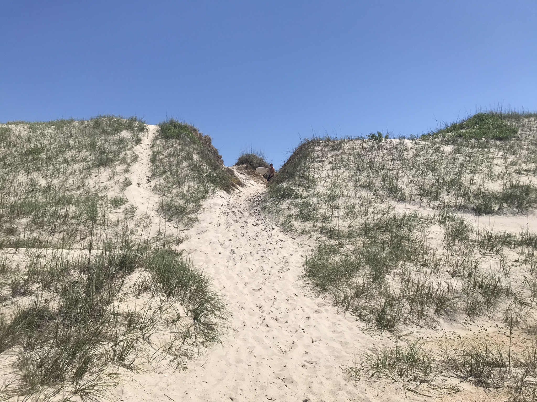
Last Monday I blogged about visiting the northern end of the Outer Banks of North Carolina in mid-May. I failed to illustrate Jockey’s Ridge adequately, so here are a few photos to show you just a little of that massive sand dune.

Amateurs learning to hang glide at Jockey’s Ridge in spite of a control burn being conducted that day.
A view of a small portion of Jockey’s Ridge
Another part of Jockey’s Ridge
Yet another view of Jockey’s Ridge.

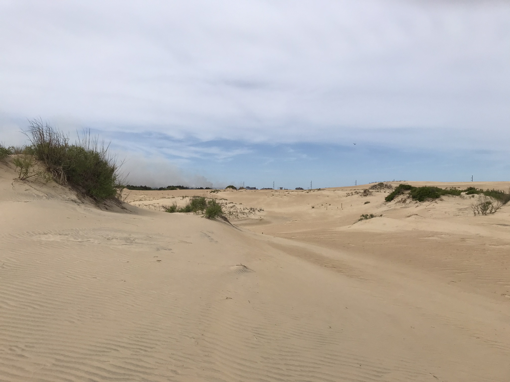
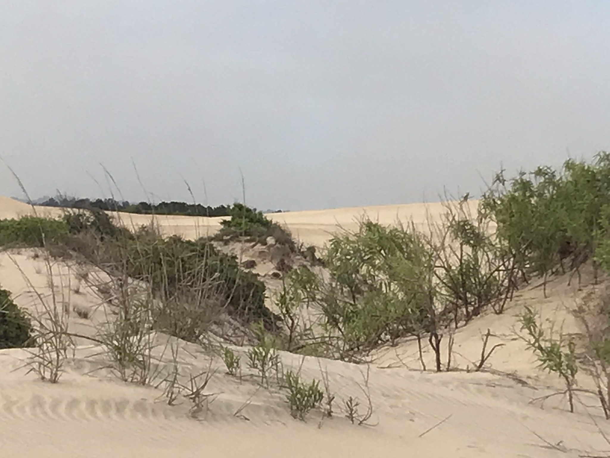
Jockey’s Ridge State Park covers 427 acres. It is estimated that the dune contains 30 million tons of sand and has been there for 7,000 years. For more information, visit https://www.ncparks.gov/state-parks/jockeys-ridge-state-park.


The southern end of the Outer Banks

The rest of today’s post covers the sights on the southern part of those barrier islands.

I hope you will be inspired by my blog to add the Outer Banks to your “bucket list” as the 120-mile-long string of barrier islands is a natural treasure everyone should get to see at least once.

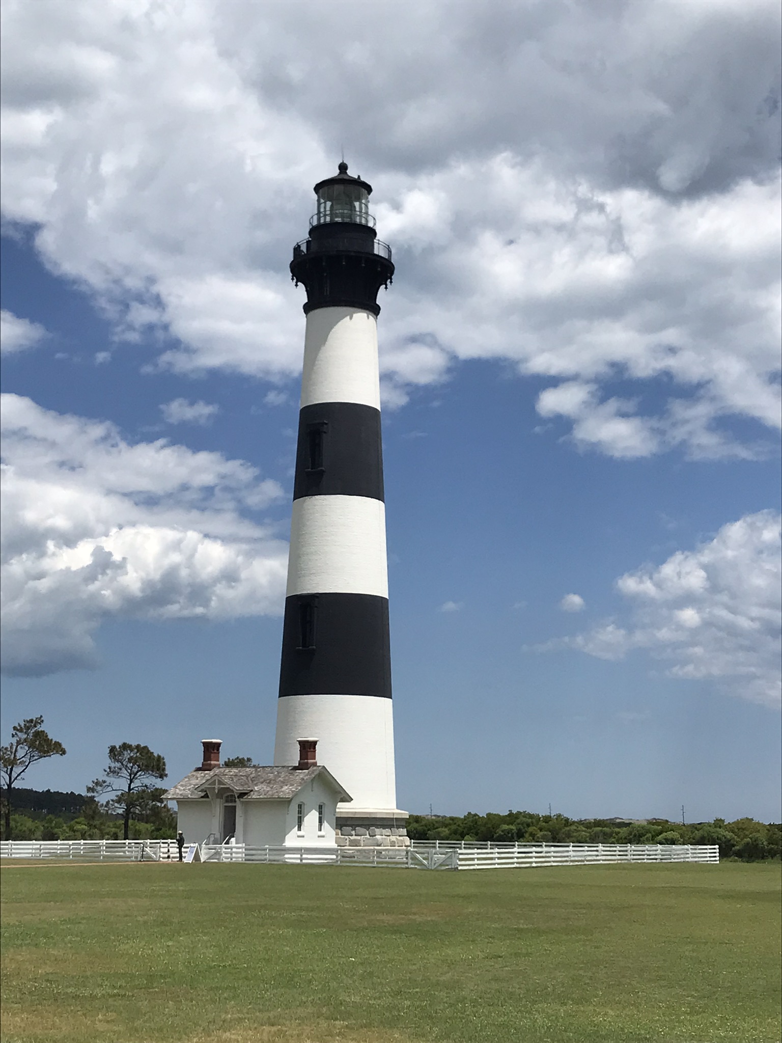
Enjoy the beautiful Bodie Island Lighthouse and adjoining boardwalk trail. https://www.nps.gov/caha/planyourvisit/bils.htm

Bodie Island Lighthouse

Set aside time to hike in the Pea Island National Wildlife Refuge. https://www.fws.gov/refuge/pea-island

Pea Island National Wildlife Refuge – View from hiking trail

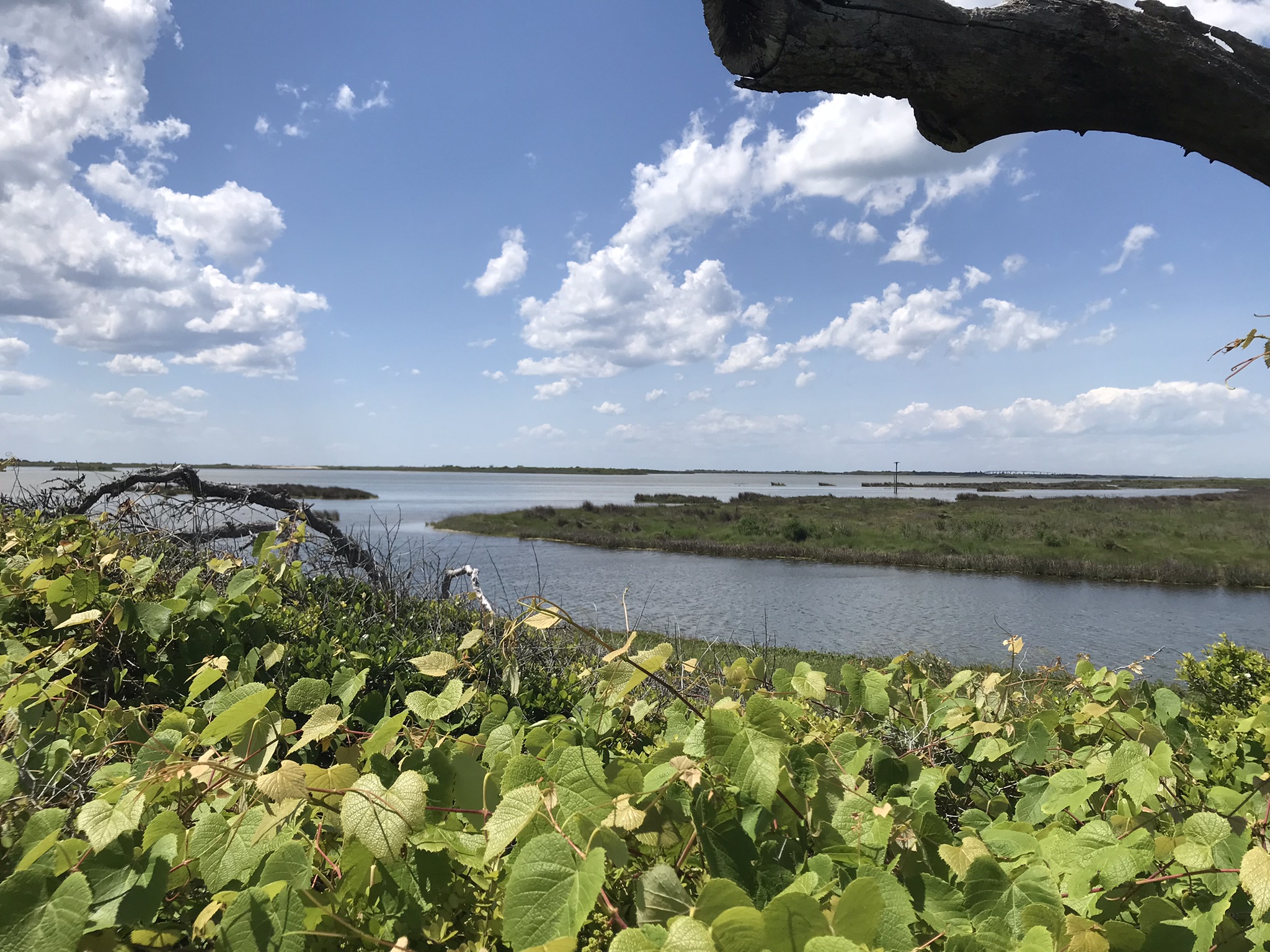
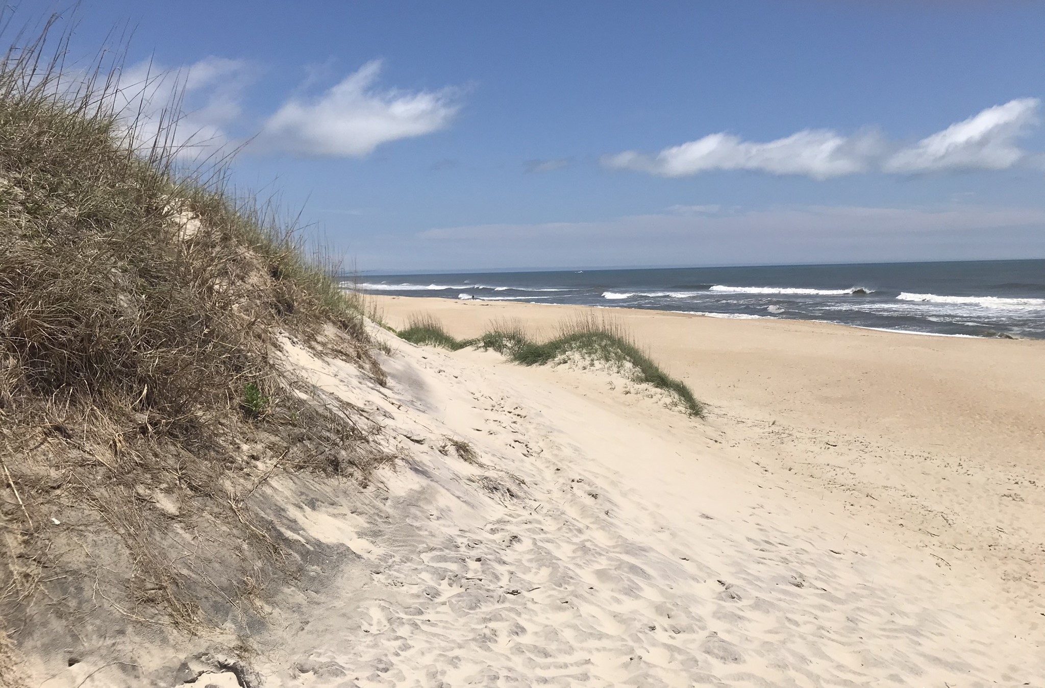
Take advantage of beach access stops along the way to enjoy the sand, the churning Atlantic Ocean, and Pamlico Sound.

You might have to hike over a sand dune to get to the ocean!
It’s worth the climb!

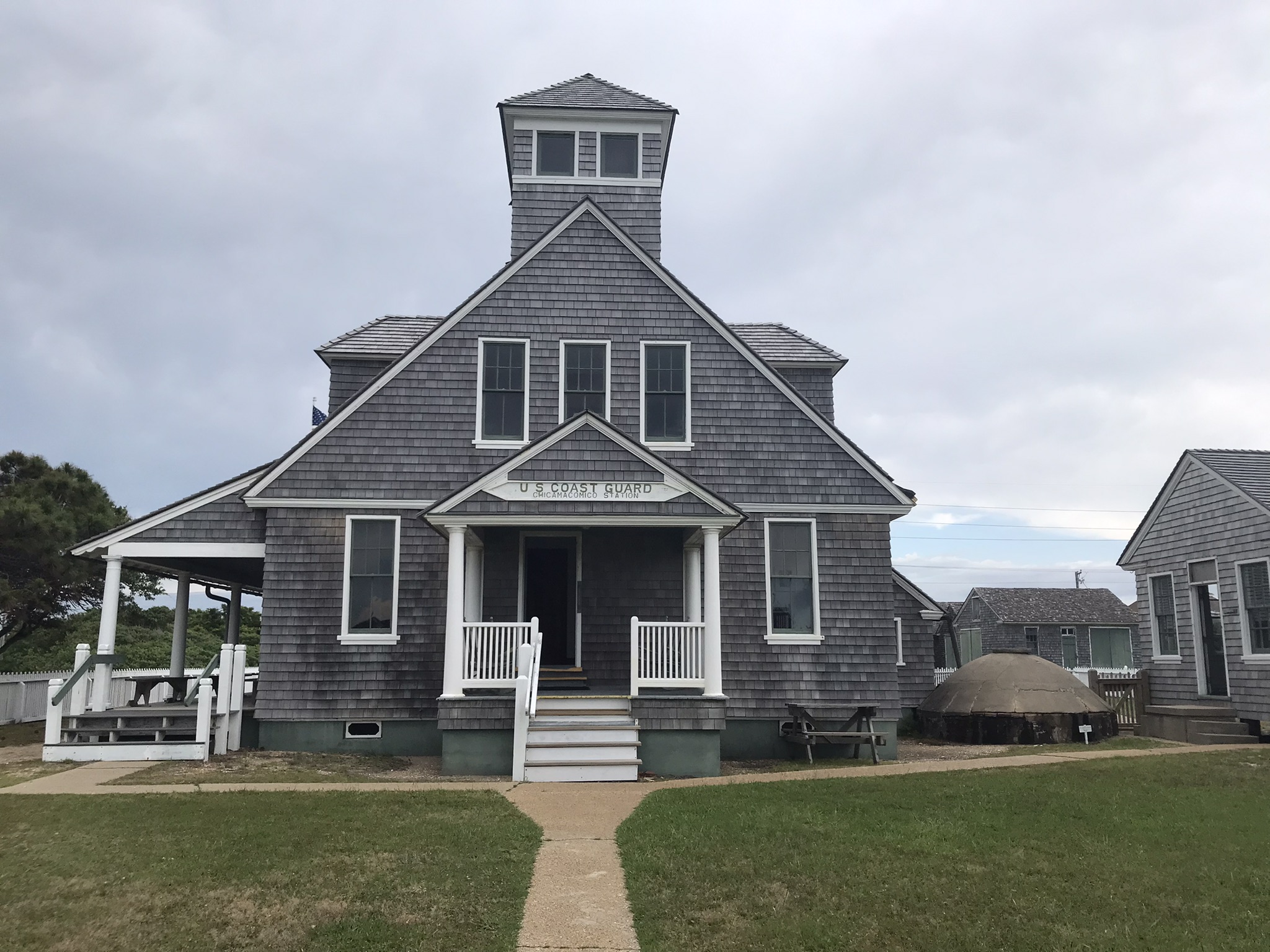
Be sure to visit the Chicamacomico Life-Saving Station in Rodanthe, established 150 years ago, to learn about the bravery of the men who risked their lives for decades to rescue sailors in distress along this “Graveyard of the Atlantic.” The video there is quite informative. For more information to help you plan your visit, this website gives details: https://chicamacomico.org/.

Chicamacomico Life Saving Station

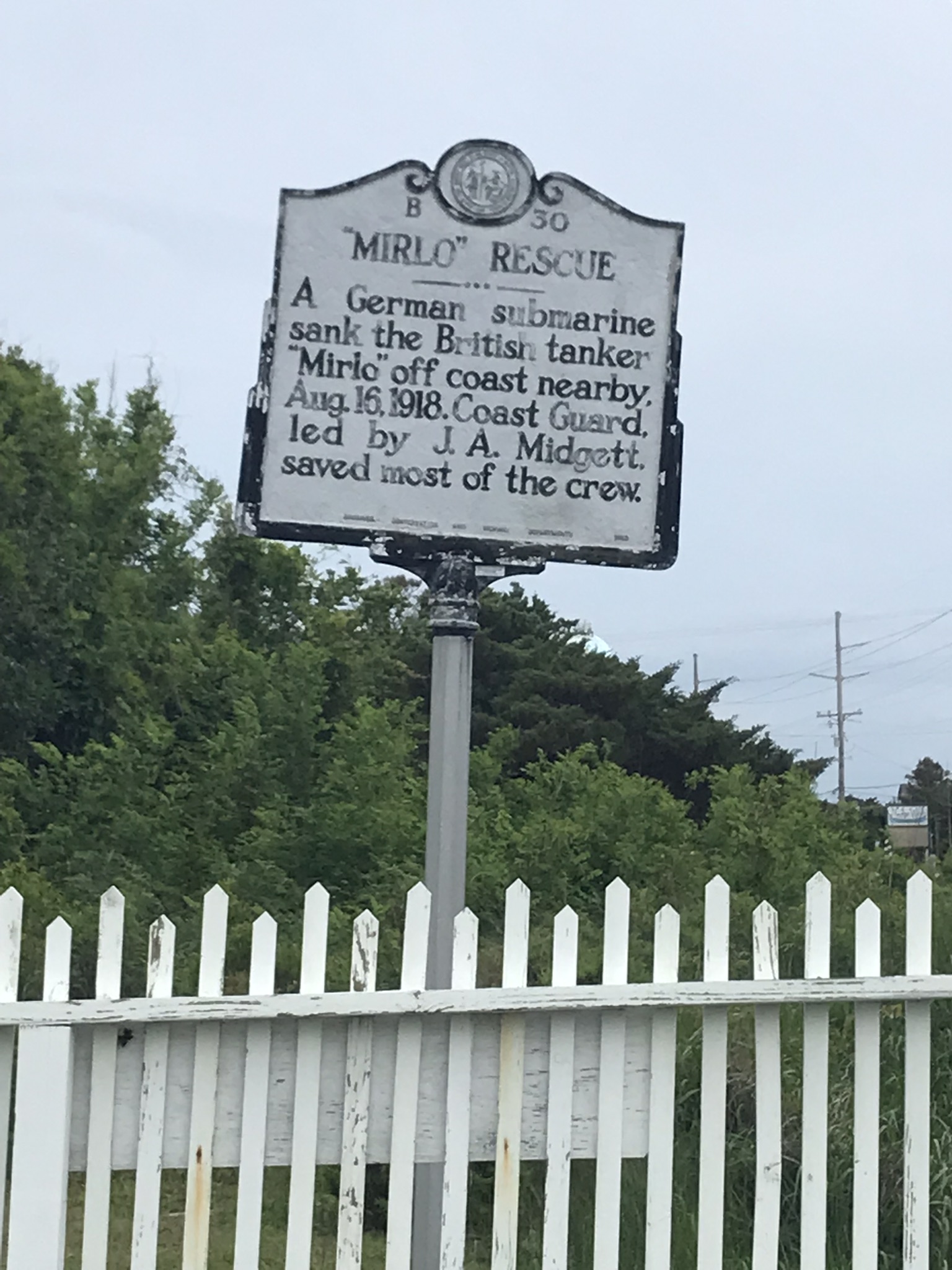
We tend to think of all of World War I taking place faraway in Europe and, indeed, most of it did; however, the Atlantic coast of the US was not immune to attack and the ramifications of sea warfare between Germany and England. Below is a photo of the roadside marker about the nearby sinking of a British tanker, Mirlo, by a German submarine. Coast Guardsmen stationed at Chicamacomico saved most of the tanker’s crew. If you want to read more about the rescue of the Mirlo, I recommend this website: https://www.ncpedia.org/mirlo-rescue.

World War I “Mirlo” Rescue Roadside Marker at Chicamacomico

Rodanthe was in the news again last week because another house fell into the ocean. According to the National Park Service, that’s the sixth privately-owned house to be claimed by the Atlantic in recent years. It makes one wonder why they were allowed to build houses there. Volunteers were sought the following day to clean up pieces of the house and its contents that had been strewn up and down the beach.

I took a picture of several houses the ocean is trying to claim on the beach at Buxton. This situation makes no sense to me.

Looks like some more houses on the Outer Banks are tempting fate!

Buxton is home to the glorious Hatteras Lighthouse – at 198.49 feet it is the tallest brick lighthouse in the United States. One word of caution, though: The Hatteras Lighthouse is undergoing two years of restoration and is currently encased in scaffolding.

Cape Hatteras Lighthouse under restoration in May 2024

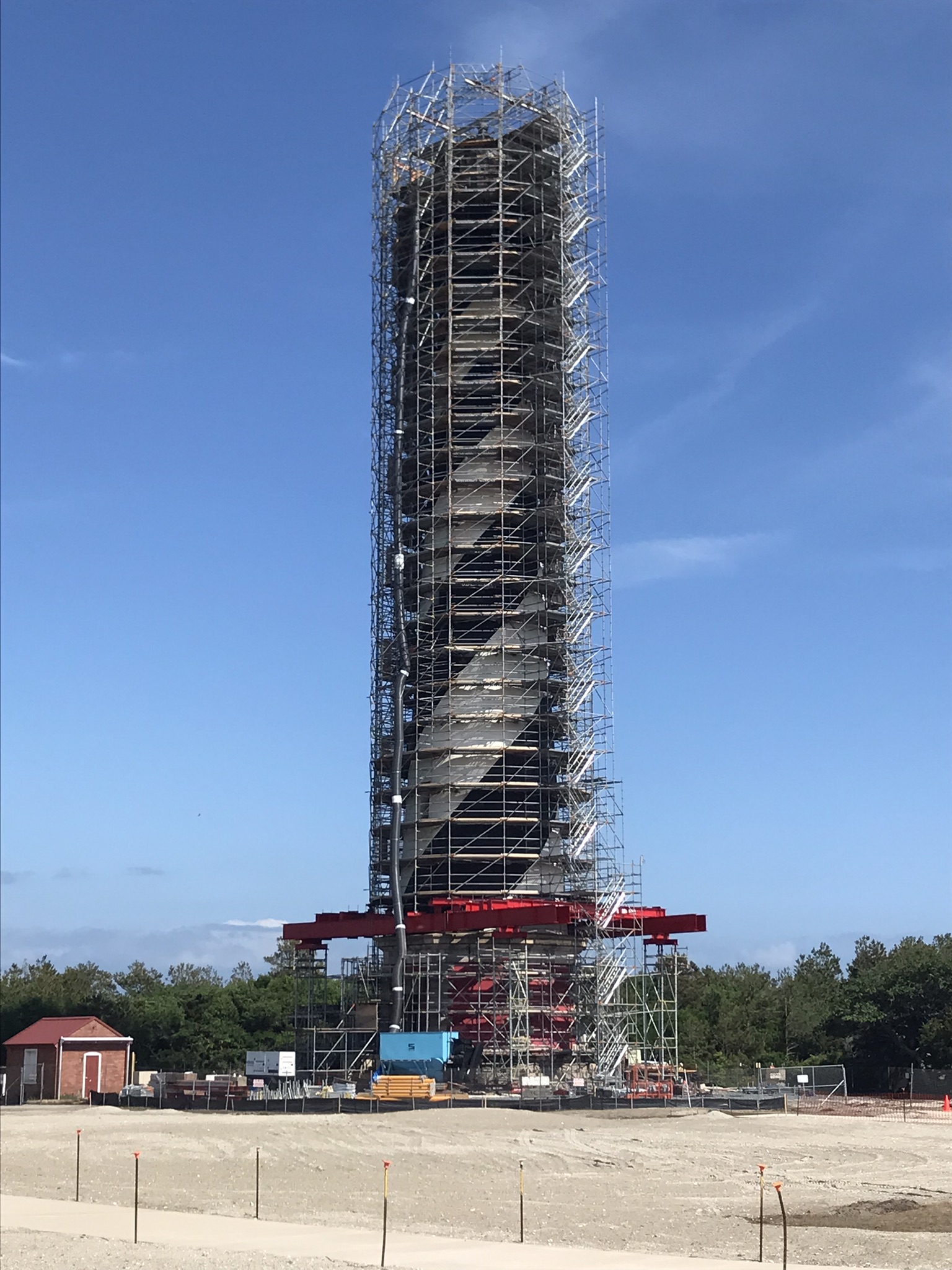
While it is closed, you can take virtual tour online at http://Cape Hatteras Light Station – Cape Hatteras National Seashore (U.S. National Park Service) (nps.gov). Fortunately, I saw it at its original location before its historic move in 1999 to save it from the ocean. The visitor center is open and you can get close enough to take pictures of the lighthouse during the 18- to 24-month restoration.

The iconic black and white painted swirl just can be seen through the scaffolding, but you might want to wait and visit in the summer of 2026 to see it in all its beauty. If you like lighthouses, you’ll love this one!

(This month’s experience reminded us of our once-in-a-lifetime trip to New York City in the mid-1980s. We rode the Staten Island Ferry so we could see the Statue of Liberty even though it was being restored and was completely encased in scaffolding. We have a knack for seeing national landmarks during their restorations!)

If you go to Hatteras Island now, you can visit the Graveyard of the Atlantic Museum. It has undergone a major remodel and was still closed when I was there on May 16-17. The grand re-opening was held on May 20, so I just missed getting to see the inside of it. Here’s the museum’s website: https://graveyardoftheatlantic.com/. Note that it is not open on weekends or state holidays.

Graveyard of the Atlantic Museum on Hatteras Island

Ocracoke Island

Storms along the Outer Banks wreak havoc with North Carolina Highway 12. Literally! The Department of Transportation constantly must remove sand from the highway, close it due to high water, and – occasionally – relocate the road.

A storm in April 2024 created all kinds of problems along NC-12. It had been restored to good condition down as far as Hatteras Village, but as of three weeks ago the portion on Ocracoke Island (http://First-timers Guide to Ocracoke Island – Visit Ocracoke NC) was still being worked on.

We had planned to take the free NC ferry from Hatteras Island to Ocracoke Island and the fee-supported NC ferry from Ocracoke to the mainland, but due to the one-lane traffic on part of Ocracoke Island we changed those plans and drove back up the Banks to Southern Shores and bridges to the mainland. (Here’s a important website, if you’re planning to use any of the 21 ferries operated by the NC Department of Transportation: https://www.ncdot.gov/travel-maps/ferry-tickets-services/routes/Pages/default.aspx.)

The Outer Banks of North Carolina are truly a national treasure. If you bemoan the fact that you must pay federal income tax, just remember that your hard-earned tax dollars help preserve miles and miles of the Outer Banks of North Carolina.

In fact, I’ve heard it suggested that if you resent paying income tax perhaps you should choose to think that all your tax dollars go to support the national parks, national seashores, and historic sites.

Look for the third and final installment of my blog series about my recent need for a change of scenery next week when I will tell you about the many points of interest we enjoyed on our way to and from the piedmont to the northeastern coastal plain of North Carolina. I think you are in for some surprises!

Until my next blog post

I hope you have a good book to read.

In case you missed the first part of my two-post blog series about the Outer Banks of North Carolina, here’s the link to my May 27, 2024 post: https://janetswritingblog.com/2024/05/27/this-writer-needed-a-change-of-scenery-part-i/.

Remember the people of Ukraine.

Thank you for taking the time to read my blog! When you have a couple of minutes, I invite you to visit my website to see what I was doing prior to my trip and the types of writing I will continue to do: https://www.janetmorrisonbooks.com.

Janet

This Writer Needed a Change of Scenery – Part I

Not wanting to publicize online that I was going out-of-town, you probably did not know that I spent much of the second full week of May on the Outer Banks of North Carolina. Having been there some 25 years ago, a return trip was on my and my sister’s “bucket lists.”

Along Cape Hatteras, NC

We packed so much into our trip that I decided to divide this “travelogue” into two parts. I will share Part II with you on Monday, June 3 and shift my usual “what I read last month” post to Monday, June 10.

Our departure was delayed by 24 hours by a storm that knocked out our electricity for 21 hours and took down literally hundreds of tree limbs in our yard. Yard clean up and some adjustments in our itinerary and reservations meant that we were exhausted when we finally left home, but the trip was salvaged. (And yard clean-up has continued since we returned home. Such is life when you live out in the country and have a yard full of large, old trees.)


The Outer Banks of North Carolina

The Outer Banks of North Carolina (often abbreviated as “OBX” these days) are truly a national natural treasure. They are a 120-mile-long string of barrier islands known as “The Graveyard of the Atlantic.”

Map showing locations of hundreds of shipwrecks along the Outer Banks – “Graveyard of the Atlantic”

Off Cape Hatteras is where the cold waters of the Labrador Stream collide with the warm water of the Gulf Stream. The clashing water and wind there constantly change to shape of the islands. It is said that the only constant on the Outer Banks is that they are constantly changing.

The massive sand dunes at Jockey’s Ridge are in a constant state of flux and shifts in height due to the wind. There’s a reason why the Wright Brothers decided to try out their “flying machine” there at Kitty Hawk in 1903. It seems like the wind never stops blowing.

To give you an example of the changes Mother Nature makes in the islands, the third (and present) Bodie (pronounced “body”) Island Lighthouse was completed in 1872 near the tip of Oregon Inlet. The lighthouse has never moved, but it is now two miles from the inlet! (https://www.nps.gov/caha/planyourvisit/bils.htm)

Bodie Island Lighthouse at dusk

The northern end of the Outer Banks

We knew the northern end of the Outer Banks had been highly developed since we were last there, but it was worse than we anticipated. It’s unfortunate that vacationers and summer-only residents wanted all the conveniences of home. Whether they wanted that or not, that’s what they got.

North from Whalebone Junction to Corolla is wall-to-wall development. It’s a shame what has been built on such a fragile sliver of the coast. The Nags Head Woods Preserve (https://www.nature.org/en-us/get-involved/how-to-help/places-we-protect/nags-head-woods-ecological-preserve/

Nags Head Woods Preserve

is still there protecting Jockey’s Ridge – the tallest living sand dunes in eastern United States. You can try your hand at learning to hang glide at Jockey’s Ridge State Park. (https://www.ncparks.gov/state-parks/jockeys-ridge-state-park)

There used to be miles of vacant land between Kitty Hawk and Duck and Corolla with the Spanish now-wild horses roaming freely. Now there’s a town called Southern Shores which runs into Duck which runs into Corolla. Multimillion dollar homes line NC Highway 12 and leave no vacant land.

The wild horses that have lived there for 400 years have now been corralled and fenced just north of Corolla for their own safety and one must pay a tour company big bucks to ride in a Hummer or a Jeep for a couple of hours in hopes of catching a glimpse of a few of those magnificent animals. We chose not to do that. We choose to remember them the way they used to be. Be sure and visit the gift shop of the Corolla Wild Horse Fund, Inc. (https://www.corollawildhorses.com/) where all proceeds support the maintenance and health of the wild horses.

At the north end of NC-12 there is a tiny parking lot. From there, one can hike and perhaps see some wild horses, but the lot was full when we were there.

We wanted to see the Currituck Beach Lighthouse again. (We love lighthouses!) Due to the growth of surrounding trees and the residential and commercial development in the last 25 years, the lighthouse at Corolla was more difficult to find than it was in the past. Nevertheless, we enjoyed seeing it one last time. (https://obcinc.org/currituck-beach-lighthouse/)

Currituck Beach Lighthouse

Meanwhile, traveling back south to Nags Head and Manteo…

Even if you aren’t interested in fishing, you might enjoy a stroll on Jennette’s Pier https://www.ncaquariums.com/jennettes-pier) at Nags Head. Associated with North Carolina Aquariums, this 1,000-foot-long concrete pier is a nice way to spend a few minutes or more. Fees are charged for fishing, but for $2.00 you can walk the pier and spend as much time as you like enjoying the views of the ocean and beach. The pier and its wooden predecessors have an interesting history.

We also enjoyed the North Carolina Aquarium (https://www.ncaquariums.com/roanoke-island) at Manteo on Roanoke Island. In the summer months there is a famous outdoor drama, “The Lost Colony” on Roanoke Island. That’s where North Carolina native Andy Griffith got his start in acting.

If you plan to visit the Outer Banks to see their stark beauty and leave some of the conveniences of home … well, at home, I recommend you spend two or three days on the northern banks if you must so you can visit the Wright Brothers National Memorial (https://www.nps.gov/wrbr/index.htm)

Wright Brothers Memorial, Kitty Hawk, NC

and the natural grandeur of Jockey’s Ridge,

Small portion of Jockey’s Ridge

the NC Aquarium,

One of the sea turtles at the NC Aquarium on Roanoke Island

and Jennette’s Pier,

Jennette’s Pier at Nags Head, NC

but then leave the traffic and hubbub behind and drive south from Whalebone Junction into the Cape Hatteras National Seashore.

Welcome sign at Cape Hatteras National Seashore

Please read my June 3, 2024 blog post to learn about my favorite part of the Outer Banks – the peaceful, wild, and beautiful southern end.


Until my next blog post

I hope you have a good book to read.

Remember the people of Ukraine.

Thank you for taking the time to read my blog! When you have a couple of minutes, I invite you to visit my website to see what I was doing prior to my trip and the types of writing I plan to continue to do:  https://www.janetmorrisonbooks.com.

Janet